


Utilising ABS study data has some challenges including using (Statistical area) SA2 and SA3 metrics which do not translate to geolocational data in most reporting softwaRE.
Data provided by ABS is now categorized by either LGA or Statistical Government Areas, as Data Analysts we can request for a new dataset from the ABS (Australian Bureau of Statistics) directly which would include postcode for a small fee. Deciding to not be limited to ABS turn-around I have decided to use a fuzzy matching of SA2 to post-code project that has already been published by ABS very recently located here: Australian Statistical Geography Standard (ASGS): Correspondences, July 2011. This is not an 100% accurate representation of postcode of suburb and upon testing had missing postcodes and suburbs. If a more accurate representation of business count by post code is needed, I had thought I needed to create my own dataset for postcode transformation.
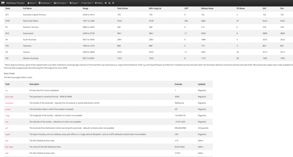
However, when all hope was lost, I stumbled upon this page by Matthew Proctor: Australian Postcodes. Matthew was also very much frustrated with Australia Post and ABS for hiding away this database of state and postcodes and forcing analysts to pay for it. He took it upon himself to develop his own database for matching sa2 to postcode data.
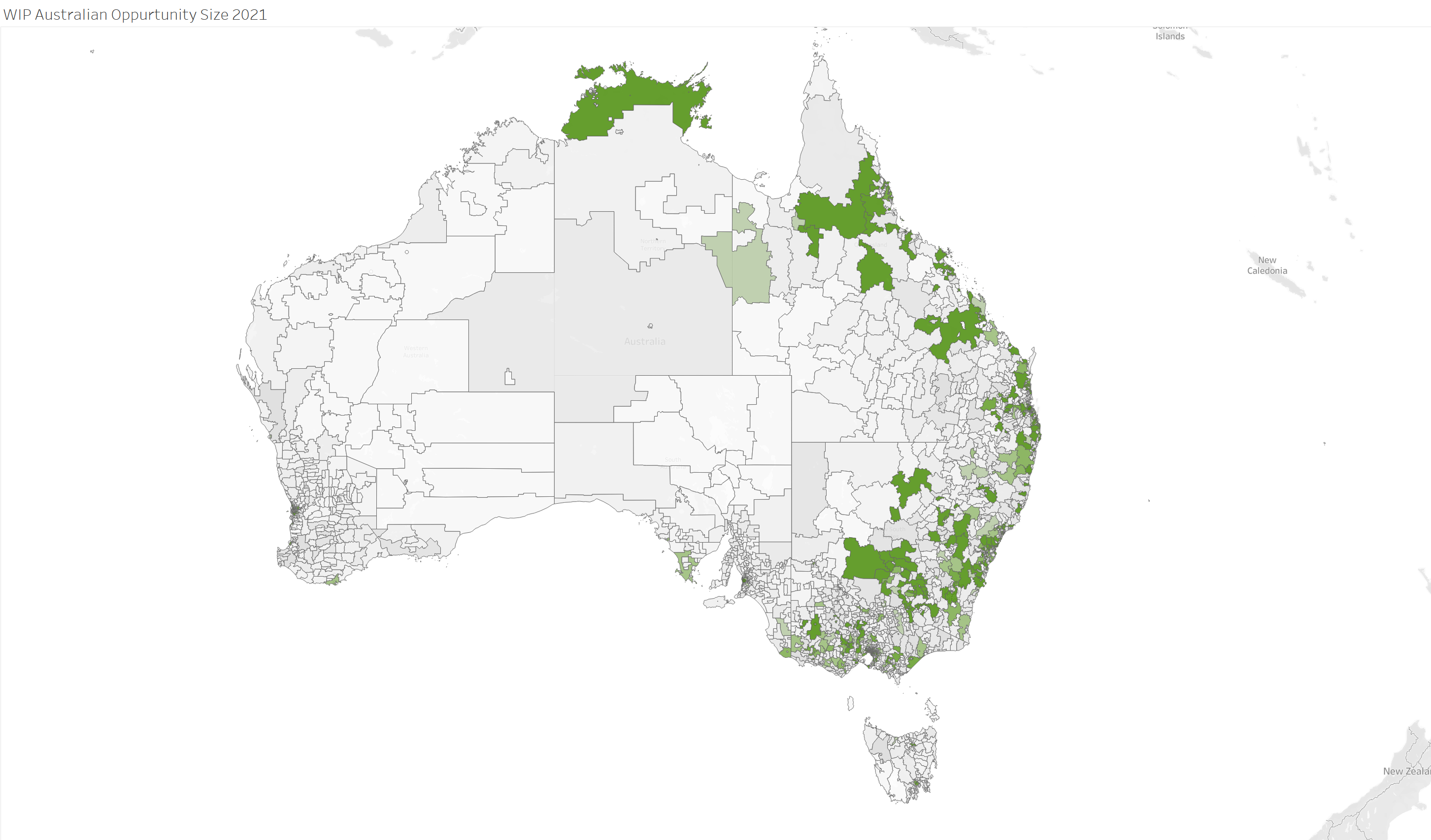
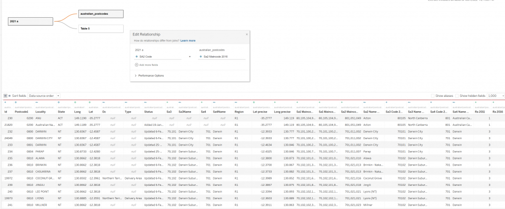
His efforts allowed me to create a blended table that could be used by reporting platforms to generate geographical reports and heatmaps using the ABS data export I was using. Using a Join on ABS SA2 Code to Matthew’s SA2 Maincode 2016 we can have a good range of fuzzy-matched postcodes and a much more accurate picture of the ABS categorized data
UPDATE 07/11/22
Upon further investigation I was able to find an even more accurate method for creating a geo-heatmap using ABS data using the available Geo Package provided via ABS website.

This database has a geometry column which (like a shapefile) can be used to associate the SA2 statistical code to a Geo-Polygon for reporting. This method requires a lot more transformation within your data warehouse but can in fact yield a much more accurate result with no margin of error on the geo-boundaries.

